


Drones in Construction: More Than Just Cool Photos
When people outside the industry think about drones on construction sites, their minds often go straight to eye-catching aerial shots. And while those sweeping images look great on a company website or in a proposal, the true value of drones goes much deeper. Today, drones are delivering data that transforms how projects are planned, monitored, and executed.
Survey Data at Scale — and in Context
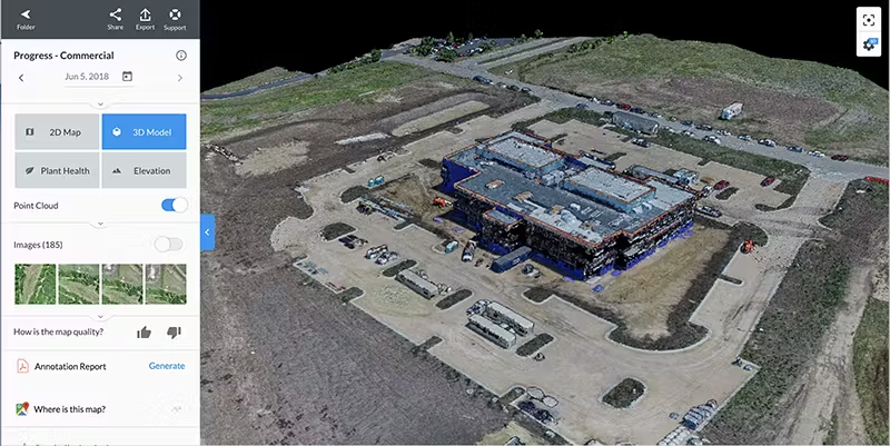
One of the most significant contributions drones bring to construction is the ability to capture highly accurate survey data in a fraction of the time it takes with traditional methods. Aerial mapping allows surveyors to cover large or difficult-to-access areas quickly, reducing the need for manual work in hazardous environments. These surveys provide high-resolution topographic maps, volumetric measurements, and 3D site models, all of which can be imported directly into design and project management tools.
Even more importantly, drone data doesn’t stand alone. It can supplement ground-based LiDAR scans and traditional photogrammetry workflows, giving teams expanded and more complete datasets. By integrating aerial and terrestrial captures, projects get the best of both worlds: broad aerial coverage and high-density detail at ground level. The result is a richer, more accurate foundation for planning, modeling, and construction.
Real-Time Progress Updates
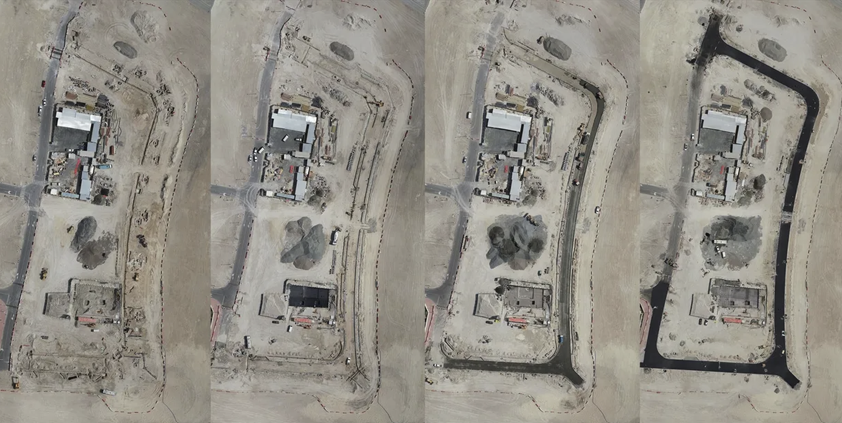
In fast-paced projects, accurate progress tracking is critical. Drones allow teams to document site conditions regularly and objectively. By capturing images and data on a weekly or even daily basis, stakeholders can compare progress against schedules, identify bottlenecks, and verify that subcontractors are on track. These updates are particularly valuable for remote project managers or owners who can’t visit the site regularly but still need reliable updates.
Enhancing Safety
Safety is always top of mind on construction sites. Drones help reduce risks by limiting the need for personnel to access dangerous areas, such as roofs, scaffolding, or unstable terrain. A drone can quickly check conditions that might otherwise require specialized safety gear or additional manpower. Moreover, drones can help detect potential hazards early — whether it’s an unprotected edge, unexpected excavation, or material stockpile blocking an access route.
Collaboration Across the Team
Because drone data can be shared digitally, everyone from architects to subcontractors benefits from a clear, up-to-date view of the project site. This transparency fosters collaboration, reduces miscommunication, and helps ensure that decisions are made with the best available information.
Conclusion
Drones in construction aren’t just about photography — they’re about providing actionable insights. By delivering survey-grade data, supplementing ground LiDAR and photogrammetry, documenting progress, and improving safety, drones empower teams to work smarter, faster, and safer. For project managers, owners, and field crews alike, the sky really is the limit when it comes to what drones can deliver.